
Thank you for supporting this site ❤️
Make a donation
Make a donation
Uruca topographic map
Click on the map to display elevation.
Thank you for supporting this site ❤️
Make a donation
Make a donation
Uruca
Uruca has an area of 8.44 km² and an elevation of 1,112 metres.
Thank you for supporting this site ❤️
Make a donation
Make a donation
About this map
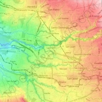
Name: Uruca topographic map, elevation, terrain.
Location: Uruca, Cantón San José, San Jose Province, 10107, Costa Rica (9.94305 -84.18003 9.97203 -84.08531)
Average elevation: 1,112 m
Minimum elevation: 942 m
Maximum elevation: 1,301 m
Thank you for supporting this site ❤️
Make a donation
Make a donation