
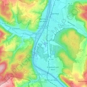
Obernburg am Main topographic map
Interactive map
Click on the map to display elevation.
About this map
Name: Obernburg am Main topographic map, elevation, terrain.
Average elevation: 188 m
Minimum elevation: 114 m
Maximum elevation: 337 m
Other topographic maps
Click on a map to view its topography, its elevation and its terrain.
Amorbach
Allemagne > Bavière > Landkreis Miltenberg
Amorbach, Landkreis Miltenberg, Bavière, 63916, Allemagne
Average elevation: 353 m
Altenbuch
Allemagne > Bavière > Landkreis Miltenberg
Altenbuch, Verwaltungsgemeinschaft Stadtprozelten, Landkreis Miltenberg, Bavière, 97901, Allemagne
Average elevation: 386 m
Faulbach
Allemagne > Bavière > Landkreis Miltenberg
Faulbach, Landkreis Miltenberg, Bavière, 97906, Allemagne
Average elevation: 246 m