
Atapark Mahallesi topographic map
Interactive map
Click on the map to display elevation.
About this map
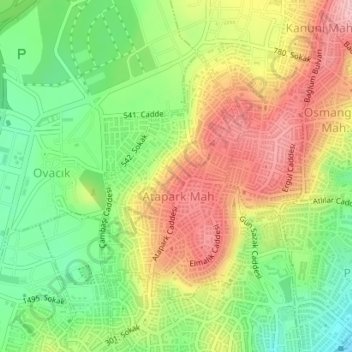
Name: Atapark Mahallesi topographic map, elevation, terrain.
Average elevation: 1,047 m
Minimum elevation: 965 m
Maximum elevation: 1,138 m
Other topographic maps
Click on a map to view its topography, its elevation and its terrain.
Ufuktepe Mahallesi
Ufuktepe Mahallesi, Keçiören, Ankara, İç Anadolu Bölgesi, Turquie
Average elevation: 1,053 m
Kalaba Mahallesi
Kalaba Mahallesi, Keçiören, Ankara, İç Anadolu Bölgesi, 06120, Turquie
Average elevation: 894 m