
Aalen topographic map
Interactive map
Click on the map to display elevation.
About this map
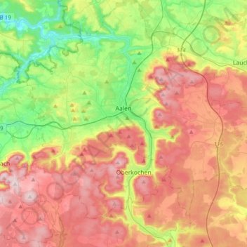
Name: Aalen topographic map, elevation, terrain.
Average elevation: 554 m
Minimum elevation: 359 m
Maximum elevation: 771 m
Other topographic maps
Click on a map to view its topography, its elevation and its terrain.
Schwäbisch Gmünd
Allemagne > Bade-Wurtemberg > Ostalbkreis
Schwäbisch Gmünd, Verwaltungsgemeinschaft Schwäbisch Gmünd, Ostalbkreis, Bade-Wurtemberg, Allemagne
Average elevation: 459 m
Wört
Allemagne > Bade-Wurtemberg > Ostalbkreis
Wört, Verwaltungsgemeinschaft Ellwangen (Jagst), Ostalbkreis, Bade-Wurtemberg, 73499, Allemagne
Average elevation: 480 m