
Carnarvon topographic map
Interactive map
Click on the map to display elevation.
About this map
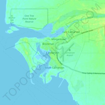
Name: Carnarvon topographic map, elevation, terrain.
Location: Carnarvon, Western Australia, Australia (-24.92261 113.61765 -24.84261 113.69765)
Average elevation: 4 m
Minimum elevation: -2 m
Maximum elevation: 13 m
Other topographic maps
Click on a map to view its topography, its elevation and its terrain.
Carnarvon
Australia > Western Australia > Carnarvon
Carnarvon, Shire Of Carnarvon, Western Australia, Australia
Average elevation: 4 m