
Rola topographic map
Interactive map
Click on the map to display elevation.
About this map
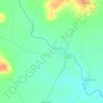
Name: Rola topographic map, elevation, terrain.
Location: Rola, Jaora Tahsil, Ratlam District, Madhya Pradesh, Índia (23.75398 75.17103 23.78821 75.20318)
Average elevation: 454 m
Minimum elevation: 438 m
Maximum elevation: 489 m