
Thank you for supporting this site ❤️
Make a donation
Make a donation
Pampady topographic map
Click on the map to display elevation.
Thank you for supporting this site ❤️
Make a donation
Make a donation
About this map
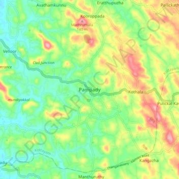
Name: Pampady topographic map, elevation, terrain.
Location: Pampady, Kottayam, Kottayam District, Kerala, 686502, India (9.54563 76.62436 9.58563 76.66436)
Average elevation: 55 m
Minimum elevation: 17 m
Maximum elevation: 135 m
Thank you for supporting this site ❤️
Make a donation
Make a donation
Other topographic maps
Click on a map to view its topography, its elevation and its terrain.