
Patia topographic map
Interactive map
Click on the map to display elevation.
About this map
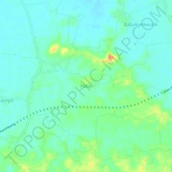
Name: Patia topographic map, elevation, terrain.
Location: Patia, Banten, Indonesia (-6.51153 105.84964 -6.47153 105.88964)
Average elevation: 13 m
Minimum elevation: 2 m
Maximum elevation: 40 m
Other topographic maps
Click on a map to view its topography, its elevation and its terrain.
Sawah Baru
Indonesia > Banten > Tangerang Selatan
Sawah Baru, Ciputat, Tangerang Selatan, Banten, Indonesia
Average elevation: 39 m