
Thank you for supporting this site ❤️
Make a donation
Make a donation
Chaguaramas topographic map
Click on the map to display elevation.
Thank you for supporting this site ❤️
Make a donation
Make a donation
About this map
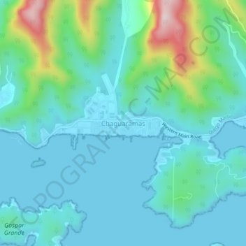
Name: Chaguaramas topographic map, elevation, terrain.
Location: Chaguaramas, Diego Martín, Trinidad y Tobago (10.64279 -61.67924 10.72279 -61.59924)
Average elevation: 59 m
Minimum elevation: -2 m
Maximum elevation: 520 m
Thank you for supporting this site ❤️
Make a donation
Make a donation