
Thank you for supporting this site ❤️
Make a donation
Make a donation
Labouquerie topographic map
Click on the map to display elevation.
Thank you for supporting this site ❤️
Make a donation
Make a donation
About this map
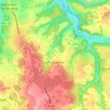
Name: Labouquerie topographic map, elevation, terrain.
Average elevation: 155 m
Minimum elevation: 73 m
Maximum elevation: 233 m
Thank you for supporting this site ❤️
Make a donation
Make a donation
Other topographic maps
Click on a map to view its topography, its elevation and its terrain.
La Borie Neuve
France > Nouvelle-Aquitaine > Dordogne > Beaumontois en Périgord > La Borie Neuve
Average elevation: 169 m
Merle Bas
France > Nouvelle-Aquitaine > Dordogne > Beaumontois en Périgord > Labouquerie
Average elevation: 147 m
Thank you for supporting this site ❤️
Make a donation
Make a donation
Pont de Belpert
France > Nouvelle-Aquitaine > Dordogne > Beaumontois en Périgord
Average elevation: 118 m