
Test Valley topographic map
Interactive map
Click on the map to display elevation.
About this map
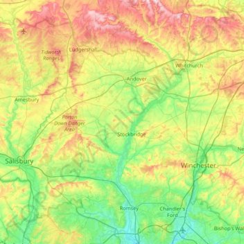
Name: Test Valley topographic map, elevation, terrain.
Location: Test Valley, Hampshire, South East, Inghilterra, Regno Unito (50.92822 -1.69412 51.33936 -1.30883)
Average elevation: 97 m
Minimum elevation: 0 m
Maximum elevation: 284 m