
Valley County topographic map
Interactive map
Click on the map to display elevation.
About this map
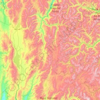
Name: Valley County topographic map, elevation, terrain.
Location: Valley County, Idaho, USA (44.15005 -116.21417 45.21800 -114.69413)
Average elevation: 1,964 m
Minimum elevation: 900 m
Maximum elevation: 3,127 m
Other topographic maps
Click on a map to view its topography, its elevation and its terrain.
Mountain Home
USA > Idaho > Mountain Home
Mountain Home, Elmore County, Idaho, USA
Average elevation: 967 m
American Falls
USA > Idaho > American Falls
American Falls, Power County, Idaho, 83211, USA
Average elevation: 1,345 m