
Thank you for supporting this site ❤️
Make a donation
Make a donation
Chunt Valiwar topographic map
Click on the map to display elevation.
Thank you for supporting this site ❤️
Make a donation
Make a donation
About this map
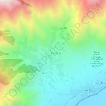
Name: Chunt Valiwar topographic map, elevation, terrain.
Location: Chunt Valiwar, Lar, Ganderbal, Jammu and Kashmir, India (34.26263 74.73445 34.30263 74.77445)
Average elevation: 2,125 m
Minimum elevation: 1,621 m
Maximum elevation: 3,149 m
Thank you for supporting this site ❤️
Make a donation
Make a donation