
Berglistüber topographic map
Interactive map
Click on the map to display elevation.
About this map
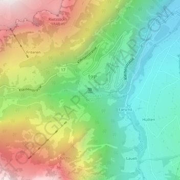
Name: Berglistüber topographic map, elevation, terrain.
Location: Berglistüber, Glarus Süd, Glaris, 8783, Suisse (46.90848 8.97528 46.90858 8.97538)
Average elevation: 1,177 m
Minimum elevation: 660 m
Maximum elevation: 2,003 m
Other topographic maps
Click on a map to view its topography, its elevation and its terrain.
Linthal
Suisse > Glaris > Glarus Süd
Linthal, Glarus Süd, Glaris, 8783, Suisse
Average elevation: 1,096 m