
Plomin Luka topographic map
Interactive map
Click on the map to display elevation.
About this map
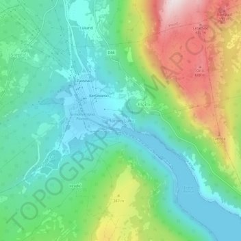
Name: Plomin Luka topographic map, elevation, terrain.
Location: Plomin Luka, Općina Kršan, Comitat d'Istrie, 52234, Croatie (45.11534 14.15433 45.15534 14.19433)
Average elevation: 216 m
Minimum elevation: -2 m
Maximum elevation: 709 m