
Meãs topographic map
Interactive map
Click on the map to display elevation.
About this map
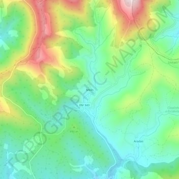
Name: Meãs topographic map, elevation, terrain.
Location: Meãs, Unhais-o-Velho, Pampilhosa da Serra, Coïmbre, Portugal (40.13147 -7.83405 40.17147 -7.79405)
Average elevation: 857 m
Minimum elevation: 687 m
Maximum elevation: 1,201 m
Other topographic maps
Click on a map to view its topography, its elevation and its terrain.
Pessegueiro
Portugal > Coïmbre > Pampilhosa da Serra
Pessegueiro, Pampilhosa da Serra, Coïmbre, Portugal
Average elevation: 617 m
Cabril
Portugal > Coïmbre > Pampilhosa da Serra
Cabril, Pampilhosa da Serra, Coïmbre, Portugal
Average elevation: 680 m