
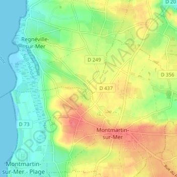
Le Rey topographic map
Interactive map
Click on the map to display elevation.
About this map
Name: Le Rey topographic map, elevation, terrain.
Average elevation: 26 m
Minimum elevation: -1 m
Maximum elevation: 59 m
Other topographic maps
Click on a map to view its topography, its elevation and its terrain.
La Trancardière
France > Normandie > Manche > Regnéville-sur-Mer
La Trancardière, Regnéville-sur-Mer, Coutances, Manche, Normandie, France métropolitaine, 50590, France
Average elevation: 13 m
Les Hauts Vents
France > Normandie > Manche > Regnéville-sur-Mer
Les Hauts Vents, Regnéville-sur-Mer, Coutances, Manche, Normandie, France métropolitaine, 50590, France
Average elevation: 17 m