
Thank you for supporting this site ❤️
Make a donation
Make a donation
Selm topographic map
Click on the map to display elevation.
Thank you for supporting this site ❤️
Make a donation
Make a donation
About this map
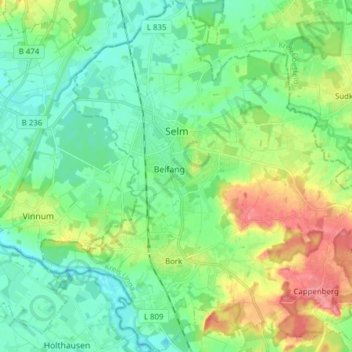
Name: Selm topographic map, elevation, terrain.
Location: Selm, Kreis Unna, North Rhine-Westphalia, 59379, Germany (51.64040 7.40882 51.73616 7.54905)
Average elevation: 65 m
Minimum elevation: 43 m
Maximum elevation: 114 m
Thank you for supporting this site ❤️
Make a donation
Make a donation
Other topographic maps
Click on a map to view its topography, its elevation and its terrain.