
Thrissur topographic map
Interactive map
Click on the map to display elevation.
Thrissur
Thrissur is the headquarters of Thrissur district, in the center of the Indian state of Kerala. The city is 75 km north-east of Kochi, 133 km south-west of Coimbatore, 124 km south-east of Kozhikode and 151 km north of Changanacherry. The city is located in a hillock called Thekkinkadu Maidan which is the second highest point in the city after the Vilangan Hills. The city has an average altitude of 2.83 meters above sea level.
About this map
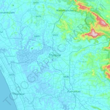
Name: Thrissur topographic map, elevation, terrain.
Location: Thrissur, Thrissur District, Kerala, 680001, India (10.36701 76.05462 10.68701 76.37462)
Average elevation: 36 m
Minimum elevation: -6 m
Maximum elevation: 516 m