
Thank you for supporting this site ❤️
Make a donation
Make a donation
Mangaka topographic map
Click on the map to display elevation.
Thank you for supporting this site ❤️
Make a donation
Make a donation
About this map
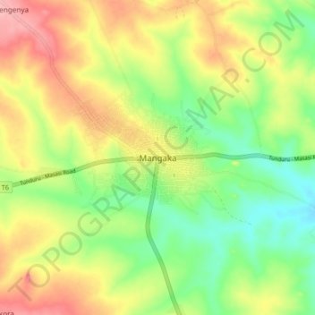
Name: Mangaka topographic map, elevation, terrain.
Location: Mangaka, Nanyumbu, Mtwara Region, Coastal Zone, Tanzania (-10.97361 38.34399 -10.89361 38.42399)
Average elevation: 358 m
Minimum elevation: 304 m
Maximum elevation: 422 m
Thank you for supporting this site ❤️
Make a donation
Make a donation
Other topographic maps
Click on a map to view its topography, its elevation and its terrain.