
Flüelen topographic map
Interactive map
Click on the map to display elevation.
About this map
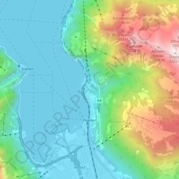
Name: Flüelen topographic map, elevation, terrain.
Location: Flüelen, Uri, 6454, Suisse (46.89316 8.59869 46.93210 8.68349)
Average elevation: 894 m
Minimum elevation: 424 m
Maximum elevation: 2,186 m
Other topographic maps
Click on a map to view its topography, its elevation and its terrain.