
Thank you for supporting this site ❤️
Make a donation
Make a donation
Mesa topographic map
Click on the map to display elevation.
Thank you for supporting this site ❤️
Make a donation
Make a donation
About this map
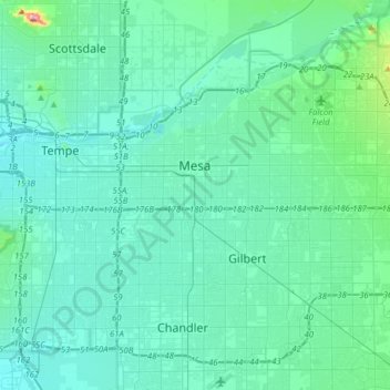
Name: Mesa topographic map, elevation, terrain.
Location: Mesa, Maricopa County, Arizona, United States (33.27762 -111.89440 33.51338 -111.58059)
Average elevation: 385 m
Minimum elevation: 336 m
Maximum elevation: 798 m
Thank you for supporting this site ❤️
Make a donation
Make a donation
Other topographic maps
Click on a map to view its topography, its elevation and its terrain.