
Đô Vinh topographic map
Interactive map
Click on the map to display elevation.
About this map
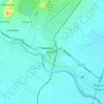
Name: Đô Vinh topographic map, elevation, terrain.
Location: Đô Vinh, Ninh Thuận, Vietnam (11.56432 108.90785 11.64432 108.98785)
Average elevation: 14 m
Minimum elevation: 1 m
Maximum elevation: 116 m
Other topographic maps
Click on a map to view its topography, its elevation and its terrain.
Bác Ái
Vietnam > Ninh Thuận > Huyện Bác Ái
Bác Ái, Huyện Bác Ái, Ninh Thuận, Vietnam
Average elevation: 322 m
Phan Rang–Tháp Chàm
Vietnam > Ninh Thuận > Phan Rang–Tháp Chàm
Phan Rang–Tháp Chàm, Ninh Thuận, Vietnam
Average elevation: 13 m