
白文镇 topographic map
Interactive map
Click on the map to display elevation.
About this map
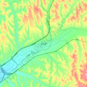
Name: 白文镇 topographic map, elevation, terrain.
Location: 白文镇, 临县, 吕梁市, 山西省, 中国 (38.13177 111.07340 38.21177 111.15340)
Average elevation: 1,234 m
Minimum elevation: 1,105 m
Maximum elevation: 1,439 m