
太平畈乡 topographic map
Interactive map
Click on the map to display elevation.
About this map
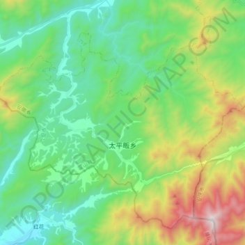
Name: 太平畈乡 topographic map, elevation, terrain.
Location: 太平畈乡, 霍山县, 安徽省, 中国 (31.01064 115.91659 31.12632 116.07219)
Average elevation: 644 m
Minimum elevation: 225 m
Maximum elevation: 1,670 m
Other topographic maps
Click on a map to view its topography, its elevation and its terrain.