
Mposa topographic map
Interactive map
Click on the map to display elevation.
About this map
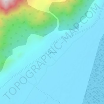
Name: Mposa topographic map, elevation, terrain.
Location: Mposa, Machinga, Southern Region, Malawi, Malawi (-15.17490 35.49770 -15.13490 35.53770)
Average elevation: 742 m
Minimum elevation: 623 m
Maximum elevation: 1,530 m
Other topographic maps
Click on a map to view its topography, its elevation and its terrain.
Liwonde National Park
Liwonde National Park, Machinga, Southern Region, Malawi, Malawi
Average elevation: 590 m