
Thank you for supporting this site ❤️
Make a donation
Make a donation
Iron Mountain topographic map
Click on the map to display elevation.
Thank you for supporting this site ❤️
Make a donation
Make a donation
About this map
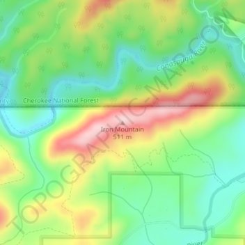
Name: Iron Mountain topographic map, elevation, terrain.
Location: Iron Mountain, Murray County, Georgia, United States (34.98642 -84.65633 34.98652 -84.65623)
Average elevation: 362 m
Minimum elevation: 266 m
Maximum elevation: 509 m
Thank you for supporting this site ❤️
Make a donation
Make a donation
Other topographic maps
Click on a map to view its topography, its elevation and its terrain.