
Fierenana topographic map
Interactive map
Click on the map to display elevation.
About this map
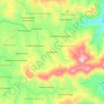
Name: Fierenana topographic map, elevation, terrain.
Location: Fierenana, Analamanga, Province d’Antananarivo, Madagascar (-18.71287 47.37148 -18.67287 47.41148)
Average elevation: 1,397 m
Minimum elevation: 1,245 m
Maximum elevation: 1,563 m