
Luxembourg topographic map
Interactive map
Click on the map to display elevation.
About this map
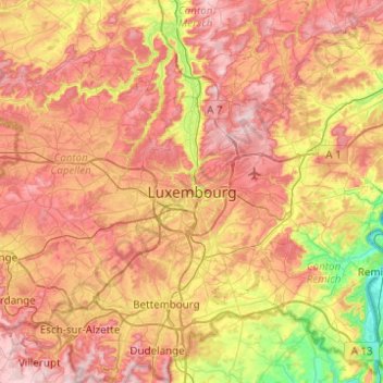
Name: Luxembourg topographic map, elevation, terrain.
Location: Luxembourg, Canton Luxembourg, Luxembourg (49.45128 5.96980 49.77128 6.28980)
Average elevation: 302 m
Minimum elevation: 136 m
Maximum elevation: 451 m
Other topographic maps
Click on a map to view its topography, its elevation and its terrain.
Luxembourg
Luxembourg > Canton Luxembourg
Luxembourg, Canton Luxembourg, Luxembourg
Average elevation: 312 m