
Comuna 13 - Oriental topographic map
Interactive map
Click on the map to display elevation.
About this map
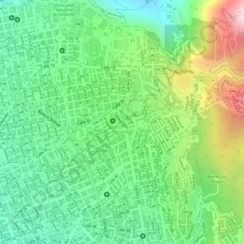
Name: Comuna 13 - Oriental topographic map, elevation, terrain.
Average elevation: 1,029 m
Minimum elevation: 862 m
Maximum elevation: 1,315 m
Other topographic maps
Click on a map to view its topography, its elevation and its terrain.
Comuna 3 - San Francisco
Colombia > Santander > Perímetro Urbano Bucaramanga
Comuna 3 - San Francisco, Perímetro Urbano Bucaramanga, Bucaramanga, Metropolitana, Santander, RAP Gran Santander, 680001, Colombia
Average elevation: 942 m