
The Green topographic map
Interactive map
Click on the map to display elevation.
About this map
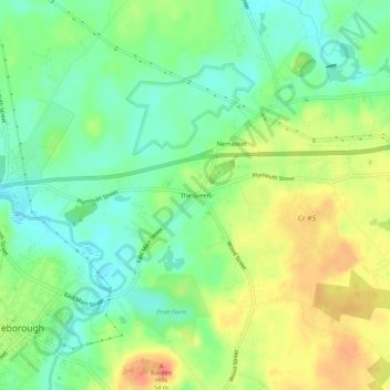
Name: The Green topographic map, elevation, terrain.
Average elevation: 30 m
Minimum elevation: 7 m
Maximum elevation: 61 m
Other topographic maps
Click on a map to view its topography, its elevation and its terrain.
South Middleboro
United States > Massachusetts > Plymouth County > Middleborough
South Middleboro, Middleborough, Plymouth County, Massachusetts, United States
Average elevation: 34 m
Camp Yomechas
United States > Massachusetts > Plymouth County > Middleborough > Camp Yomechas
Camp Yomechas, Middleborough, Plymouth County, Massachusetts, United States
Average elevation: 35 m