
Thank you for supporting this site ❤️
Make a donation
Make a donation
Hwange topographic map
Click on the map to display elevation.
Thank you for supporting this site ❤️
Make a donation
Make a donation
About this map
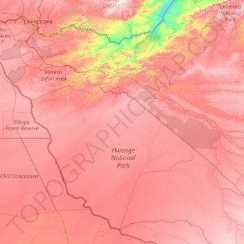
Name: Hwange topographic map, elevation, terrain.
Location: Hwange, Matabeleland North Province, Zimbabwe (-19.88947 25.23730 -17.79137 27.75694)
Average elevation: 968 m
Minimum elevation: 479 m
Maximum elevation: 1,334 m
Thank you for supporting this site ❤️
Make a donation
Make a donation