
Langrug topographic map
Click on the map to display elevation.
About this map
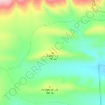
Name: Langrug topographic map, elevation, terrain.
Location: Langrug, George, Western Cape, South Africa (-33.73329 21.61251 -33.73319 21.61261)
Average elevation: 334 m
Minimum elevation: 234 m
Maximum elevation: 508 m
Other topographic maps
Click on a map to view its topography, its elevation and its terrain.