
Thank you for supporting this site ❤️
Make a donation
Make a donation
Dorchester topographic map
Click on the map to display elevation.
Thank you for supporting this site ❤️
Make a donation
Make a donation
About this map
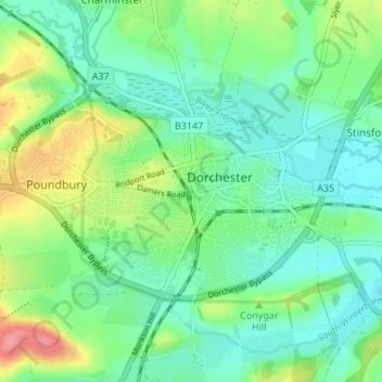
Name: Dorchester topographic map, elevation, terrain.
Location: Dorchester, Dorset, England, United Kingdom (50.69972 -2.47376 50.72363 -2.40616)
Average elevation: 72 m
Minimum elevation: 48 m
Maximum elevation: 134 m
Thank you for supporting this site ❤️
Make a donation
Make a donation