
Thank you for supporting this site ❤️
Make a donation
Make a donation
Lügde topographic map
Click on the map to display elevation.
Thank you for supporting this site ❤️
Make a donation
Make a donation
About this map
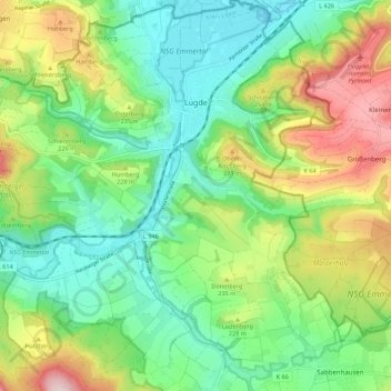
Name: Lügde topographic map, elevation, terrain.
Location: Lügde, Kreis Lippe, North Rhine-Westphalia, Germany (51.90982 9.18605 51.97769 9.28623)
Average elevation: 196 m
Minimum elevation: 89 m
Maximum elevation: 400 m
Thank you for supporting this site ❤️
Make a donation
Make a donation
Other topographic maps
Click on a map to view its topography, its elevation and its terrain.