
Thank you for supporting this site ❤️
Make a donation
Make a donation
Kveda Sairme topographic map
Click on the map to display elevation.
Thank you for supporting this site ❤️
Make a donation
Make a donation
About this map
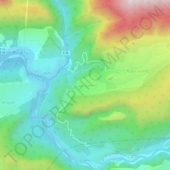
Name: Kveda Sairme topographic map, elevation, terrain.
Average elevation: 669 m
Minimum elevation: 359 m
Maximum elevation: 1,344 m
Thank you for supporting this site ❤️
Make a donation
Make a donation
Other topographic maps
Click on a map to view its topography, its elevation and its terrain.
Green Lake
Georgia > Racha-Lechkhumi and Kvemo Svaneti > Tsageri Municipality
Average elevation: 1,139 m