
Thank you for supporting this site ❤️
Make a donation
Make a donation
Xangongo topographic map
Click on the map to display elevation.
Thank you for supporting this site ❤️
Make a donation
Make a donation
About this map
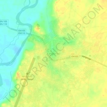
Name: Xangongo topographic map, elevation, terrain.
Location: Xangongo, Cunene, Angola (-16.76426 14.95637 -16.72426 14.99637)
Average elevation: 1,108 m
Minimum elevation: 1,092 m
Maximum elevation: 1,119 m
Thank you for supporting this site ❤️
Make a donation
Make a donation