
Vagli Sotto topographic map
Interactive map
Click on the map to display elevation.
About this map
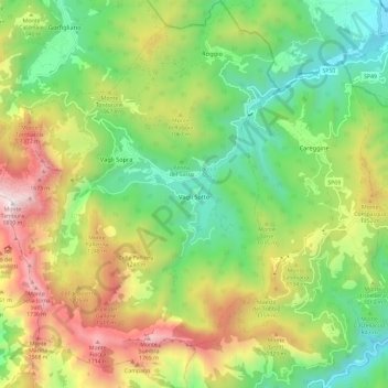
Name: Vagli Sotto topographic map, elevation, terrain.
Location: Vagli Sotto, Unione Comuni Garfagnana, Lucca, Toscane, Italie (44.06726 10.22839 44.15218 10.31458)
Average elevation: 959 m
Minimum elevation: 378 m
Maximum elevation: 1,872 m