
Heimbach topographic map
Interactive map
Click on the map to display elevation.
About this map
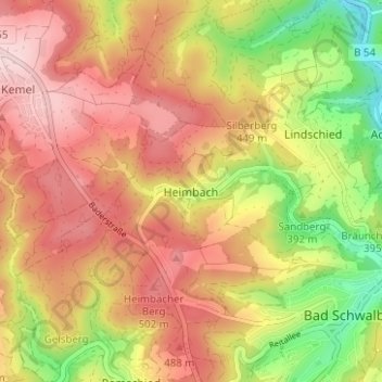
Name: Heimbach topographic map, elevation, terrain.
Location: Heimbach, Bad Schwalbach, Rheingau-Taunus-Kreis, Hesse, Alemania (50.13459 8.02507 50.17459 8.06507)
Average elevation: 421 m
Minimum elevation: 265 m
Maximum elevation: 541 m