
Thank you for supporting this site ❤️
Make a donation
Make a donation
Midlaren topographic map
Click on the map to display elevation.
Thank you for supporting this site ❤️
Make a donation
Make a donation
About this map
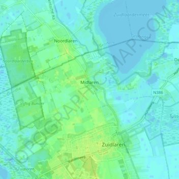
Name: Midlaren topographic map, elevation, terrain.
Location: Midlaren, Tynaarlo, Drenthe, Netherlands (53.09528 6.63455 53.12118 6.71139)
Average elevation: 4 m
Minimum elevation: -4 m
Maximum elevation: 14 m
Thank you for supporting this site ❤️
Make a donation
Make a donation