
Thank you for supporting this site ❤️
Make a donation
Make a donation
Waurika topographic map
Click on the map to display elevation.
Thank you for supporting this site ❤️
Make a donation
Make a donation
Waurika
Waurika Lake, completed in 1980, is 11 miles long, contains 192,000 acre feet of water at its normal elevation of 951 feet, has a surface area of 10,000 acres, and features 80 miles of shoreline.
Thank you for supporting this site ❤️
Make a donation
Make a donation
About this map
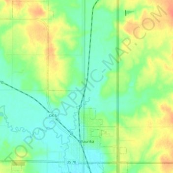
Name: Waurika topographic map, elevation, terrain.
Location: Waurika, Jefferson County, Oklahoma, 73573, United States (34.15331 -98.05186 34.22460 -97.97739)
Average elevation: 282 m
Minimum elevation: 265 m
Maximum elevation: 307 m
Thank you for supporting this site ❤️
Make a donation
Make a donation