
Thank you for supporting this site ❤️
Make a donation
Make a donation
Oshakati topographic map
Click on the map to display elevation.
Thank you for supporting this site ❤️
Make a donation
Make a donation
About this map
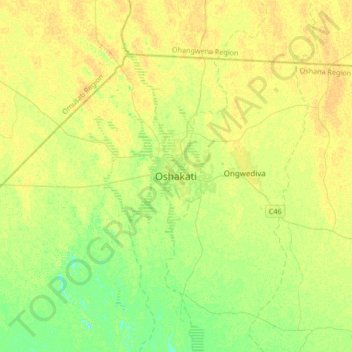
Name: Oshakati topographic map, elevation, terrain.
Location: Oshakati, Oshana, Namibia (-17.94265 15.53860 -17.62265 15.85860)
Average elevation: 1,098 m
Minimum elevation: 1,086 m
Maximum elevation: 1,105 m
Thank you for supporting this site ❤️
Make a donation
Make a donation