
Thank you for supporting this site ❤️
Make a donation
Make a donation
El Dorado topographic map
Click on the map to display elevation.
Thank you for supporting this site ❤️
Make a donation
Make a donation
About this map
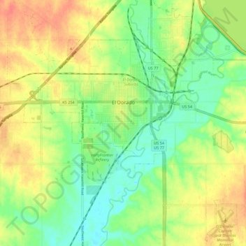
Name: El Dorado topographic map, elevation, terrain.
Location: El Dorado, Butler County, Kansas, 67042, United States (37.76663 -96.90675 37.85314 -96.81165)
Average elevation: 405 m
Minimum elevation: 382 m
Maximum elevation: 432 m
Thank you for supporting this site ❤️
Make a donation
Make a donation
Other topographic maps
Click on a map to view its topography, its elevation and its terrain.