
Charleston topographic map
Interactive map
Click on the map to display elevation.
About this map
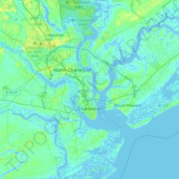
Name: Charleston topographic map, elevation, terrain.
Average elevation: 4 m
Minimum elevation: -5 m
Maximum elevation: 23 m
Other topographic maps
Click on a map to view its topography, its elevation and its terrain.
Mount Pleasant
Vereinigte Staaten von Amerika > Süd-Carolina > Charleston County
Mount Pleasant, Charleston County, Süd-Carolina, Vereinigte Staaten von Amerika
Average elevation: 3 m