
Mangrol Taluka topographic map
Interactive map
Click on the map to display elevation.
About this map
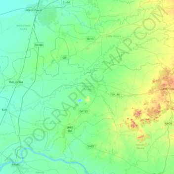
Name: Mangrol Taluka topographic map, elevation, terrain.
Location: Mangrol Taluka, Surat, Gujarat, India (21.34087 72.90725 21.56806 73.33134)
Average elevation: 48 m
Minimum elevation: -8 m
Maximum elevation: 220 m
Other topographic maps
Click on a map to view its topography, its elevation and its terrain.