
Thank you for supporting this site ❤️
Make a donation
Make a donation
Al Qasriyah topographic map
Click on the map to display elevation.
Thank you for supporting this site ❤️
Make a donation
Make a donation
About this map
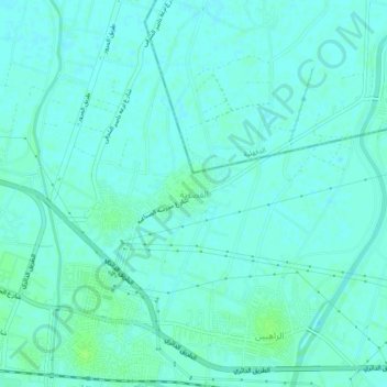
Name: Al Qasriyah topographic map, elevation, terrain.
Location: Al Qasriyah, Western, 31836, Egypt (30.96750 31.18639 31.00750 31.22639)
Average elevation: 6 m
Minimum elevation: 3 m
Maximum elevation: 12 m
Thank you for supporting this site ❤️
Make a donation
Make a donation
Other topographic maps
Click on a map to view its topography, its elevation and its terrain.