
Herkenbosch topographic map
Interactive map
Click on the map to display elevation.
About this map
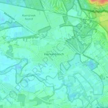
Name: Herkenbosch topographic map, elevation, terrain.
Location: Herkenbosch, Roerdalen, Limbourg, Pays-Bas, 6075, Pays-Bas (51.13489 6.04601 51.17489 6.08601)
Average elevation: 31 m
Minimum elevation: 23 m
Maximum elevation: 65 m