
Iron County topographic map
Interactive map
Click on the map to display elevation.
About this map
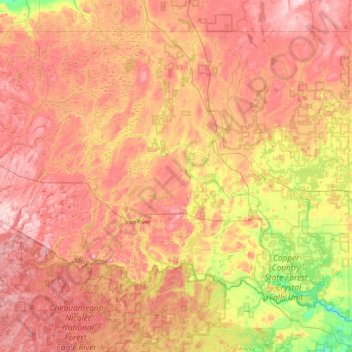
Name: Iron County topographic map, elevation, terrain.
Location: Iron County, Michigan, USA (45.92084 -88.99238 46.41970 -88.11728)
Average elevation: 469 m
Minimum elevation: 338 m
Maximum elevation: 578 m
Other topographic maps
Click on a map to view its topography, its elevation and its terrain.
Village of Saint Charles
USA > Michigan > Village of Saint Charles
Village of Saint Charles, Saint Charles Township, Saginaw County, Michigan, 48655, USA
Average elevation: 182 m
Isle Royale National Park
Isle Royale National Park, Greenstone Ridge Trail, Houghton Township, Keweenaw County, Michigan, USA
Average elevation: 189 m