
Brand topographic map
Interactive map
Click on the map to display elevation.
About this map
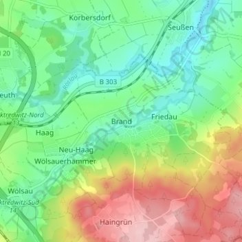
Name: Brand topographic map, elevation, terrain.
Average elevation: 536 m
Minimum elevation: 471 m
Maximum elevation: 648 m
Other topographic maps
Click on a map to view its topography, its elevation and its terrain.
Ziegelhütte
Deutschland > Bayern > Landkreis Wunsiedel im Fichtelgebirge > Marktredwitz
Ziegelhütte, Marktredwitz, Landkreis Wunsiedel im Fichtelgebirge, Bayern, 95679, Deutschland
Average elevation: 563 m
Haingrün
Deutschland > Bayern > Landkreis Wunsiedel im Fichtelgebirge > Marktredwitz
Haingrün, Marktredwitz, Landkreis Wunsiedel im Fichtelgebirge, Bayern, 95615, Deutschland
Average elevation: 574 m