
Montella topographic map
Interactive map
Click on the map to display elevation.
About this map
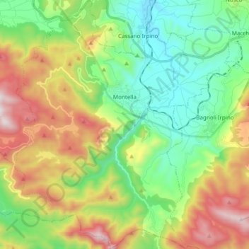
Name: Montella topographic map, elevation, terrain.
Location: Montella, AV, CAM, Italia (40.77262 14.95065 40.88658 15.08227)
Average elevation: 897 m
Minimum elevation: 448 m
Maximum elevation: 1,693 m